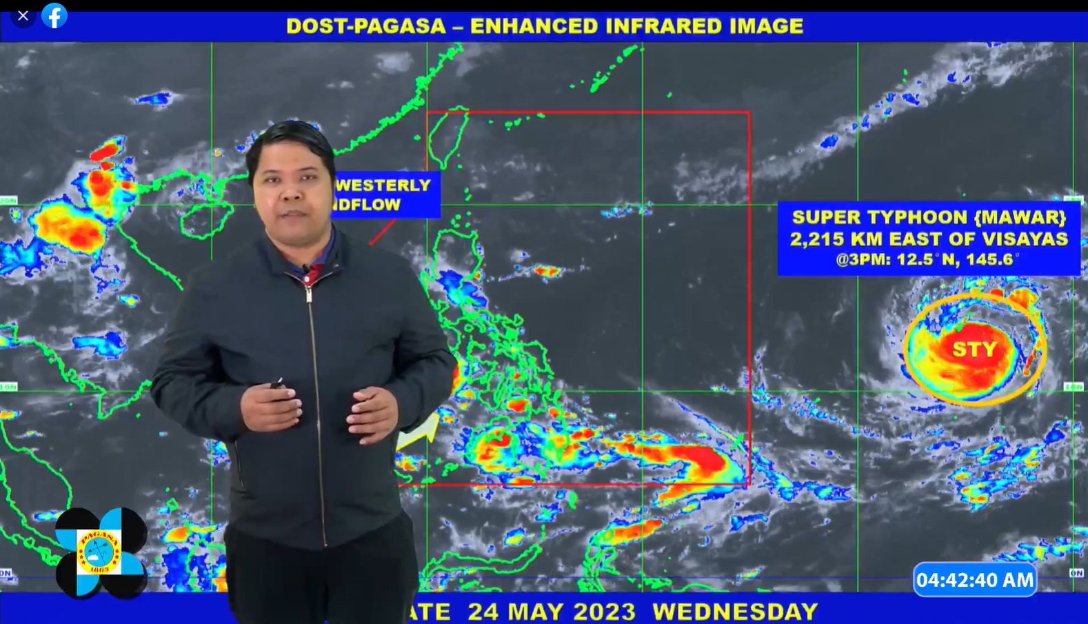
QUEZON CITY (PIA) -- The Philippine Atmospheric, Geophysical, and Astronomical Services Administration continues to monitor the movement of Super Typhoon ‘Mawar’ (international name) which is expected to enter the Philippine Area of Responsibility (PAR) late Friday or early Saturday.
Different government agencies are now implementing measures based on emergency preparedness and response protocols, including dissemination of warnings, preparation of relief assistance for distribution, and rescue teams for deployment. This is to ensure zero casualties in the communities.
The National Disaster Risk Reduction and Management Council (NDRRMC) has alerted its regional counterparts, Local Government Units (LGUs), and communities to prepare for the typhoon.
The Office of the Civil Defense also conducted a pre-disaster risk assessment with science agencies to identify the LGUs at risk and determine the prescribed alert level and corresponding response protocols.
Airports operated by the Civil Aviation Authority of the Philippines (CAAP) have implemented precautionary measures in anticipation of this weather disturbance.
Airports located within the possible path of Mawar have conducted pre-typhoon coordination meetings and assessments. Malasakit Help Kits including food packs have been prepared and will be distributed to affected travelers.
Meanwhile, the Department of Social Welfare and Development has already prepositioned a total of 797,051 family food packs worth P565.78 million in its regional offices.
There are also 110,667 FFPs available in Disaster Response Centers, with the breakdown as follows: 101,525 FFPS at the National Resource Operations Center (NROC) in Pasay City and 9,142 FFPs at the Visayas Disaster Resource Center.
Moreover, the Philippine Coast Guard (PCG) has deployed its response groups and Quick Response Teams (QRTs) in the Cordillera Administrative Region (CAR) and Ilocos Region.
In addition, PCG's search and rescue (SAR) assets have been prepositioned to be immediately deployed in residential areas in case of flooding.
The PCG Auxiliary (PCGA) is also preparing relief supplies and family packs to be distributed to the evacuation centers.
The Department of the Interior and Local Government (DILG), meanwhile, has directed all its regional directors to coordinate with their respective Regional Disaster Risk Reduction and Management Councils (RDDRMCs) and to remind all local government units (LGUs) to prepare for the coming storm.
The DILG said all LGUs, especially those in areas with recent experience of extended or prolonged rain occurrences and/or landslides or floods, continue to monitor all PAGASA weather advisories and typhoon bulletins and conduct precautionary measures.
As of 4:00 am today, the center of the eye of ‘Mawar’ was 2,130 km East of Southeastern Luzon (14.2°N, 143.9°E) with maximum sustained winds of 185 km per hour (kph) near the center, gustiness of up to 230 kph and a central pressure of 930 hPa. It is moving West Northwestward at 15 kph.
According to PAGASA, the current track scenario shows that the rain bands of the typhoon may bring heavy rains over Cagayan Valley between Sunday and Tuesday next week. In addition, strong to gale-force conditions may be experienced in most areas of the region, except for the Batanes-Babuyan Islands area which may have gale-to-storm-force conditions, which will result in the hoisting of Tropical Cyclone Wind Signal in the coming days.
Though it is not expected to make landfall, ‘Mawar’ is forecast to enhance the Southwest Monsoon and may trigger monsoon rains over the western portions of Luzon and Visayas beginning on Sunday or Monday. However, the monsoon rains scenario may still change due to the dependence of Southwest Monsoon enhancement on the track and intensity of ‘Mawar’.
The government continues to remind the public to prepare for the storm by monitoring the advisories and heeding the warnings issued by relevant agencies. (KSAA – PIA CPSD)


