TAGBILARAN CITY, Bohol, March 22 (PIA) -- Bohol leads the provinces in the country in disaster risk reduction and mitigation after it signed a Memorandum of Understanding (MOU) in the use of the government’s central source of information for accurate and efficient hazards and risk assessment.
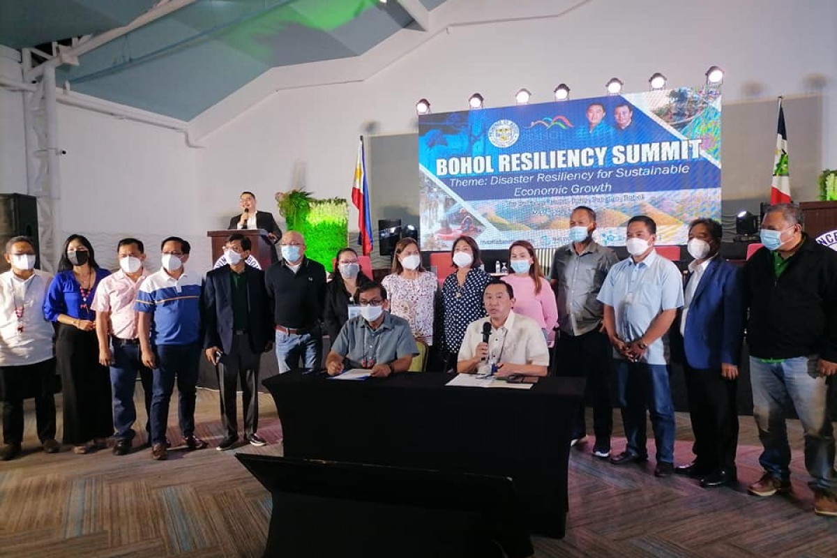
During the recent Bohol Resiliency Summit on March 15 at the Pavilion of the Bellevue Hotel in Panglao, Bohol Gov. Arthur Yap signed an a MOU with the Department of Science and Technology (DOST) on the use the GeoRiskPH, which is both a governance and information communication technology geospatial platform which can be crucial in increasing the province’s resilience against natural disasters.
Prone to natural and man-made disasters, Bohol has faced earthquakes, landslides, tidal surges, flooding, droughts, and recently the super-typhoon, which has pushed local leaders to get communities involved in the efforts to mitigate various risks, ensure effective and efficient disaster response, and implement a timely and efficient recovery, while building better by learning from the experience and considering these risks in the future.
In response, the Bohol provincial government with the World Bank, National Disaster and Risk Reduction Management Council, Philippine Disaster Resilience Foundation, and Holy Name University conducted the Bohol Resiliency Summit adopting Disaster Resiliency for Sustainable Economic Growth.
The event brought together national government agencies, local government units (LGUs), the academe, private sector, development planners, civil society organizations and community representatives to share experiences, learning and knowledge to gain better understanding in development planning, capital utilization and helping each other to insulate communities from future disasters.
Under the GeoRiskPH MOU, Bohol can now share protocols and platforms to understand and mitigate hazards, exposure and other risk information to help its people, communities, local governments, and national agencies prepare and plan how to reduce the risks from natural hazards.
With the use of GeoRiskPH’s Platform as stipulated in the MOU, Bohol LGUs may now access HazardHunterPH, an online user-friendly application designed to generate natural and manmade hazard assessment tool to serve individuals, communities and institutions, thus allowing people to predetermine risks when building on a site, and pre-plan for the eventuality of the disaster by approximating the risk and over-engineering.
GeoRiskPH platform also affords LGUs with hazard visualization and analytics with GeoAnalytics, which would generate disaster information and could be a crucial guide for disaster relief operations and development of resettlement areas.
GeoRiskPH access also allows LGUs to tap necessary data while on the field with a web and phone-based application in the GeoMapperPH, and generate figures crucial in policy reforms.
GeoMapperPH allows communities with access to populate the national exposure database with this exposure data mapper, situation data mapper, by collecting, reporting and updating data for improved accuracy.
While both HazardHunterPH and GeoAnalytics are easily accessible by the public, GeoMapping, however, allows access only to members with credentials.
Bohol Provincial Planning and Development Officer Atty. John Titus Vistal pointed out that Bohol’s MOA is the first among provincial governments in the country, while the Phivolcs have already offered access to these resources for highly urbanized cities in the country. (RAHC/PIA7 Bohol)


