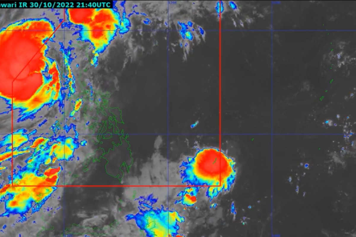
RIZAL (PIA) -- Tropical Depression (TD) 'Queenie' has entered the Philippine Area of Responsibility (PAR) at 5:00 a.m. on Monday, according to the Philippine Atmospheric, Geophysical and Astronomical Services Administration (PAGASA).
Meanwhile, Tropical Cyclone Wind Signal (TCWS) No. 1 remains hoisted over 20 areas as Tropical Storm Paeng moves toward the northwestern limit of PAR.
In its 5 a.m. bulletin, the state weather bureau raised Signal No. 1 on the following areas:
- Ilocos Norte
- Ilocos Sur
- La Union
- Pangasinan
- Apayao
- Kalinga
- Abra
- Mountain Province
- Ifugao
- Benguet
- Nueva Vizcaya
- Western portion of Cagayan (Santa Praxedes, Claveria, Sanchez-Mira, Pamplona, Abulug, Ballesteros, Allacapan, Lasam, Santo Niño, Piat, Tuao, Rizal)
- Western portion of Isabela (Cordon, City of Santiago, San Mateo, Ramon, Alicia, San Isidro, Quezon, Mallig, Roxas, San Manuel, Aurora, Cabatuan)
- Northwestern portion of Quirino (Cabarroguis, Diffun, Saguday)
- Northern, western, and southern portions of Nueva Ecija (Cuyapo, City of Gapan, Talavera, San Leonardo, Santo Domingo, Rizal, San Isidro, Zaragoza, Llanera, Guimba, Aliaga, Science City of Muñoz, General Mamerto Natividad, Cabanatuan City, Carranglan, Quezon, San Antonio, San Jose City, Santa Rosa, Lupao, Nampicuan, Talugtug, Peñaranda, Jaen, Licab, Cabiao, Pantabangan)
- Pampanga
- Bataan
- Tarlac
- Zambales
- Western portion of Bulacan (Hagonoy, Paombong, City of Malolos, Guiguinto, Calumpit, Pulilan, Plaridel, Baliuag, Bustos, San Miguel, San Ildefonso, San Rafael)
At 4:00 a.m., the center of 'Paeng' was estimated to be at 320 km west northwest of Iba, Zambales or 340 km west of Dagupan City, Pangasinan carrying maximum sustained winds of 85 kilometers per hour (kph) near the center and gustiness of up to 105 kph.
At present, it is moving west northwestward at 10 km/h. It has strong to gale-force winds that extend outwards up to 650 km from the center.
Paeng is forecast to exit the Philippine Area of Responsibility this afternoon or evening. (EEDC/PIA-CPSD)