BATARAZA, Palawan -- The Mines and Geosciences Bureau (MGB) Mimaropa conducted geologic mapping of Sapa and Katipunan Quadrangles in Bataraza, Palawan, on April 12-27, 2023.
Sapa Quadrangle mostly covers Barangays Sapa, Malitub, and Tagnato, while Katipunan Quadrangle covers Barangays Tagnato, Puring, Buliluyan, Tabud, and Tagolango. The two quadrangles are dominated by massive and bedded clastic rocks and limestones that were categorized into different formational units: Panas Formation, Pandian Formation, Iwahig Formation, and Sumbiling Limestone.
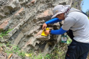
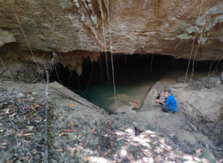
Quartz-rich, massive sandstones and interbedded sandstones, siltstones and mudstones were distributed on the hills of Barangays Sapa and Malitub. Meanwhile, limestone exposures were extensively distributed along the road networks from Brgy. Sapa southward to Brgy. Buliluyan and westward to Brgy. Tagolango. These reefal limestones are comprised of calcirudites, calcarenites, and calcisiltites possibly indicating their differing depositional environments across the atoll.
This undertaking to identify and map the distribution of the different lithologic units covering the said quadrangles in the southernmost barangays of Bataraza is part of the regular activities of the MGB under its National Geological Quadrangle Mapping Program (NGQMP).
The NGQMP aims to undertake a systematic geologic mapping of the entire country on a 1:50,000 scale utilizing Interferometric Synthetic Aperture Radar topographic maps as base maps and Geographic Information System technology for data processing and map generation.
The geologic maps and technical reports from this activity provides useful information to stakeholders for the development of the country’s mineral, energy and water resources; and for environmental protection, land use classification, planning, and development.
The remaining official geologic mapping target of MGB Mimaropa for CY 2023 is the Barong-Barong Quadrangle which covers the portions of Brooke’s Point, Sofronio Española, and Rizal in Palawan. (Press Release from MGB MIMAROPA/GATS/PIA MIMAROPA)